Best Way to Display Hidden Georeferenced TIFFs on Feature Selection?

Hi all,
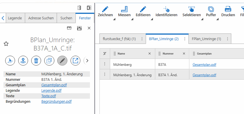
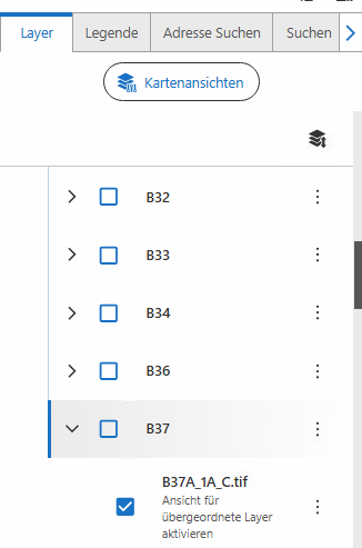
I’d like to understand how to automatically make a layer visible based on an Identify action. Specifically, I have a set of georeferenced TIFFs that are not visible by default. When a user clicks on a larger reference layer, how can I implement a mechanism that automatically displays the underlying TIFF?
I was thinking about using a workflow or a custom button. Do you have any other suggestions or approaches that might work better?
For Example, this below is the name of a georeferced tiff that, for now, once I figure out which one it is, I have to make visible manually. I'd like it to be more automatic.
0
Please sign in to leave a comment.
Comments
0 comments