Toggle Label Visibility for Map Image Service layers?

Hi. For one of our apps, we use a map image service (mainly to support more advanced symbology). So, we add the entire service to the webmap, rather than layer by layer. This creates a limitation as end users are unable to toggle labels visibility. That's expected I believe.
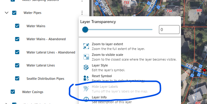
I'm wondering if there's a way to create a workflow that would allow users to toggle label visibility? The sublayer object does have a labelsVisible property. Getting a reference to the sublayer is easy enough, but I'm not clear if that property can be changed in workflow. Activities like ‘Set Layer Property’ or ‘Evaluate Expression’ could be used perhaps.
So, looking for the following:
1) Is this even feasible?
2) If so, what's the best way to go about it?
Thanks
-

Hi, I am under the impression that VertiGIS is currently aware of this issue and are working on a resolution. Our team has a ticket open with them on this exact issue.
“There are still a couple of outstanding bugs related to this behaviour. The most prevalent is the current inability to hide or show labels for Map Services, however, I can share that this item is currently under development as bug 386494. ”
1 -
Hi Liza. I wasn't sure if this had been working previously. Thanks for confirming and sharing that this is under development. Good to know.
Meanwhile, I did create a workflow prototype to solve it. Not sure if I'll use it though, since it seems likely the issue will be resolved in an upcoming release.
0
Please sign in to leave a comment.
Comments
2 comments