Question
Why does snapping of shapefiles imported into GEONIS not work?
Problem
GPS recordings (points / polylines) are read into GEONIS as shapefiles. When snapping is enabled for these files, the following error message appears:
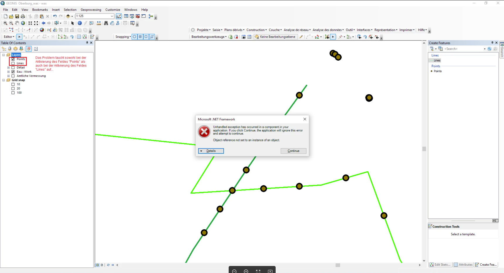
The problem occurs both when activating the "Points" layer and when activating the "Lines" layer under the "GEONIS snapping environment settings" tab.
Solution
However, this only happens if in GEONIS Administrator under "Application Settings" in the "Snapping" section the "User-specific" field is checked (regardless of the setting of the "All Users" field).
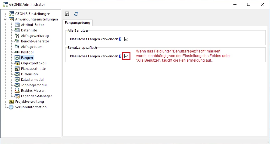
Therefore, it is recommended to hide the "User-specific" field.
Comments
0 comments
Article is closed for comments.