Use a maritime chart service
Has anyone had any luck using a Maritime Chart Service? Or is this not supported at all by GCX?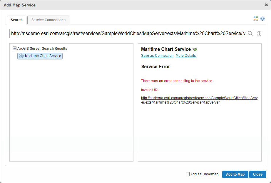
When trying to add this service: http://nsdemo.esri.com/arcgis/rest/services/SampleWorldCities/MapServer/exts/Maritime%20Chart%20Service/MapServer I get an error message:
0
-

Try adding the WMS flavor - http://nsdemo.esri.com/arcgis/rest/services/SampleWorldCities/MapServer/exts/MaritimeChartService/WMSServer
Worked for me!0 -

Yes adding WMS works sometimes (not all the times) but adding MapServer doesnt work. 0
Du måste logga in om du vill lämna en kommentar.
Kommentarer
2 kommentarer