Add/Edit Text Markup
Slutfört
RELEASED: Web 5.15
With the HTLM5 viewer for Geocortex Essentials my users are able to add and edit Text markup. The absence of this feature in Geocortex Web is possibly the main thing preventing us from transitioning to Geocortex Web at present. The ability to add multi-line text rather than the single line option in the HTML5 viewer would be better still.
-

We are working on it ... moving this to Coming Soon. Feel free to drop me an e-mail at cam.barnard@vertigis.com if you'd like to see where we are going with this feature and to share a bit about how your users use this feature and why. I have two primary cases captured that seem to encompass > 95% of the usage so far.
0 -

Is this feature available now? We also rely on it and I can't find it in VSW
0 -
You can put text on the map, and control its size, font, colour, etc.
Print outs will contain this text.
These core functions are done with Location Notes (which also include other capabilities not found in Geocortex).
0 -
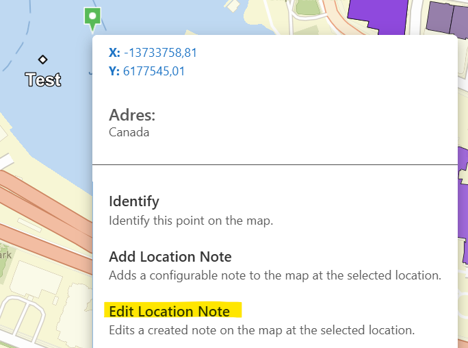
Is there a way to edit the text markups in the location notes after they have been added? The Edit Markups tool doesn't seem to work with the location notes.
0 -

Yes you can edit a Location Note.
 0
0 -

As I’m rewriting our mapping apps from GVH to GSW I’m seeing some of these issues with adding graphics and text. We have many users that don’t have desktop GIS, and currently use GVH to make some basic maps. The usual case is they want to draw a graphic at a location, draw an arrow pointing to it (in lieu of a callout box), and write some descriptive text. They may occasionally label surrounding streets etc. They then print the map or screen capture it to an image. Fairly basic stuff, but something that they use quite often. We need to have a good solution to doing this in GSW before we fully transition.
Here are some of the challenges I’m having with the GSW tools. I’m on 5.38.1, so maybe some of these have been addressed:
- There is no arrow template, which our users frequently use in lieu of a fully functional callout box
- Unlike GVH, snapping doesn’t work against map service layers, only feature service layers. We use map services wherever possible for speed of rendering, so this is a new limitation for us
- Text is now entered as a location note:
- It creates a graphic dot at the location you clicked with the text below it. You can’t remove the dot (why would you want a dot when entering text?), or have the text placed directly at the location you clicked.
- You can’t rotate it (important for labeling streets etc)
- Location notes are separate from graphic markups. You can’t use the Edit Markup tool to select location notes. Having a completely separate set of tools will cause confusion
Cam Barnard, are there any plans to enhance graphics/text in the near future?
Thanks,
Chris
1
Du måste logga in om du vill lämna en kommentar.
Kommentarer
6 kommentarer