Be able to add layer from address file (Excel or CSV) and perform batch geocode

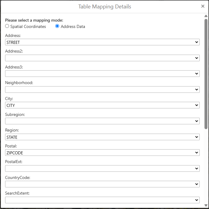
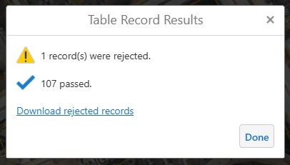
The “Import from XLSX” and “Import from CSV” commands only take files with lat/long values. GVH Upload Data tool is able to read addresses from XLSX and CSV files, perform batch geocode and add the features to the map. The tool can also display rejected records to the end user. Uploading address data to the map is a critical function in our GVH applications. Can we request that VSW provide a similar OOTB tool for this functionality?
7
Vous devez vous connecter pour laisser un commentaire.
Commentaires
0 commentaire