Calculate the distance from a user defined point to the nearest railway-line in 3D

Hello community!
I’m new to the VetriGIS Studio platform and may need some guidance.
What I’m trying to make, is a workflow that calculate the distance from a user defined point to the nearest railway-line in 3D. The 3D-part is because the railway-line may be in a tunnel belove.
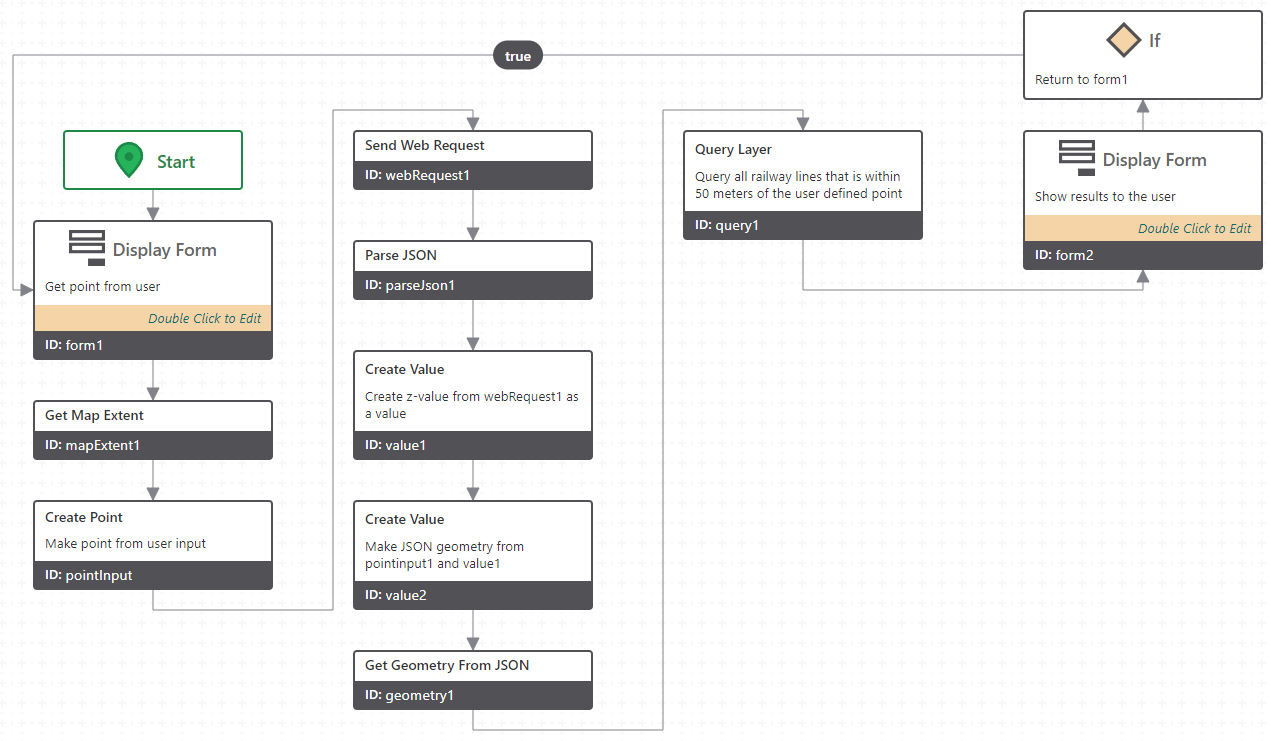
I’ve managed to do it in 2D (as shown in the picture), but the 3D-part is a bit more challenging.

To calculate the distance in 3D, I need to add a Z-value to the user defined point.
Here in Norway, the Norwegian Mapping Authority has an API where you can send in a X/Y-coordinate and get back the Z for that point.
I’ve done this with a web request, then parsed the JSON and extracted the Z-value to a new value. Then used Get Geometry From JSON to recreate the point with the Z-value.
Then I query my railway-layer to get all railway lines that is within 50 meters of the user defined point.
Then comes the part I’m struggling with.
How do I find the nearest part on the railway line and get the height from that point? (The height of the line, not the height on the surface).
Vous devez vous connecter pour laisser un commentaire.
Commentaires
0 commentaire