Set labels for picked geometry individually

I would love to have the ability to set labels on each of the geometries that have been digitized.
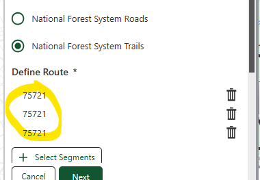
For instance if a user digitzes a point on a road, I would want to get the road reference for that point so the user knows which road they have clicked on.

-

I also am trying to figure out how to get this to work. The challenge it seems, is that the default ‘Location’ label for the geometry label (itemLabel property) gets populated once the map is clicked, before the intersect/buffer of the point and the query can return the value to replace ‘Location’ with. If I delete one of the clicked map values with the trash can icon, it seems to grab what I am using below, but even though I am populating in a loop, the value always remains static… like so, showing OBJIDs:
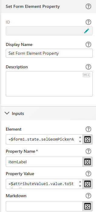
How the WF populates:
 0
0
Please sign in to leave a comment.
Comments
1 comment