Data Skewed
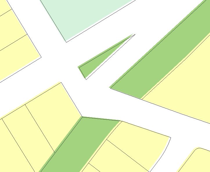
I've attached 2 screenshots. The one showing the mxd used to create the map service shows the coloured polygons aligned with the black parcel lines. But in the viewer (the other screenshot), alignment is off. How can I correct this? GVH 2.6.1, GE 4.5.1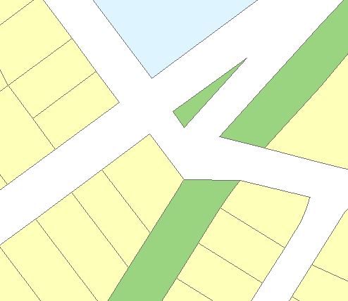
0
-

Are both of those polygons in the same service?
Looks like a transformation issue. You should manually set the transformation (under Data Frame Properties) to one that works better. The default transformation used by ArcGIS Server is not always the best choice.0 -

Thanks Dan! Worked like a charm! 0 -
No problem. We had the same issue and it took opening a support case with ESRI to figure it out. 0
Please sign in to leave a comment.
Comments
3 comments